Spearfish Canyon
This is the second post in a series of three chronicling my mother and I’s annual trip. This year we headed through Wyoming to South Dakota and the Black Hills.
It rained overnight our first night. The hotel was comfortable and warm, the breakfast delicious. Mom and I have grown attached to our stays at LaQuinta Inns. Since we are always traveling with her little dog Sophie, having a pet-friendly hotel is important. LaQuinta always allows pets. We even saw someone with a big fluffy cat walking it on a leash/harness outside. The cat didn’t even seem to mind the rain.
 But the sun was trying to break through the clouds, so we packed our warm jackets and headed west to Spearfish, with the intent of going south through Spearfish Canyon. I had been told by a new work colleague that the canyon was gorgeous and full of water falls. He had spent much of his life in Spearfish, so I trusted him. He knew what he was talking about. And despite the mostly cloudy (although with some intermittent sun) day, it was indeed beautiful. (I’m going to spam you with lots of pictures at the end of his post.)
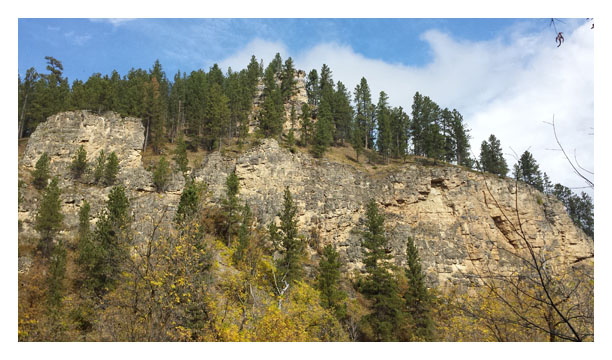
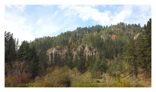
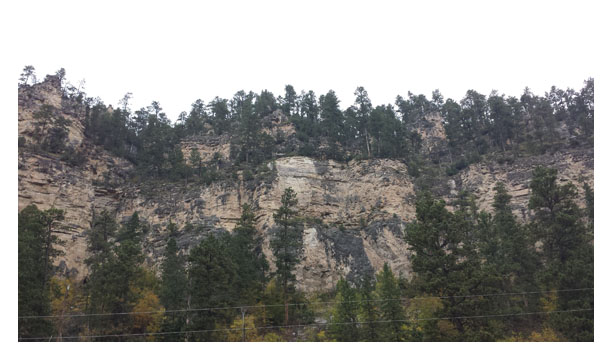
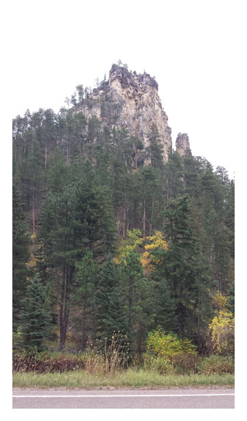
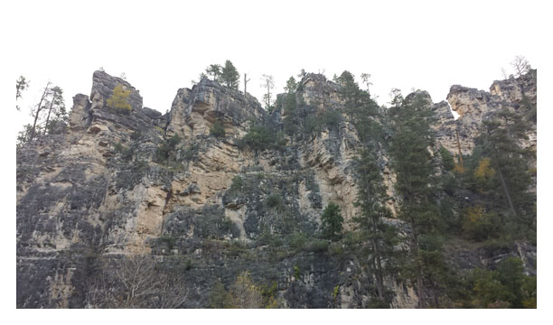
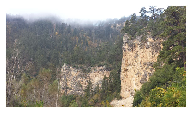
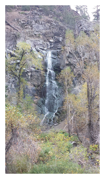
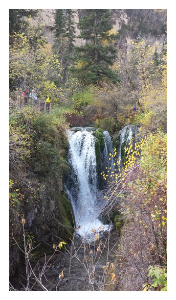
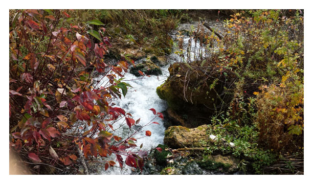
The first falls we came to were Bridal Veil Falls. This set of falls was tall and thin, and part of Spearfish Creek, which had carved the canyon over the last tens of thousands of years. This far north, the creek is rather narrow. Mom and I were fascinated with the layers of rock in the canyon walls – some yellow, some white, some black as lava. Other color in the canyon was provided by green leafy ferns and evergreen trees, yellow aspen, and red sumac. Everywhere we looked was a burst of color – either rock or vegetation.
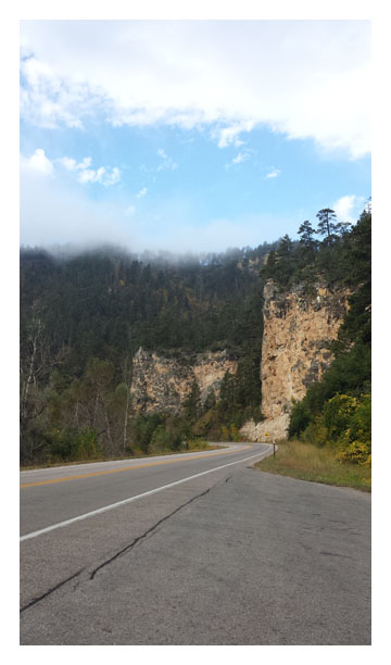
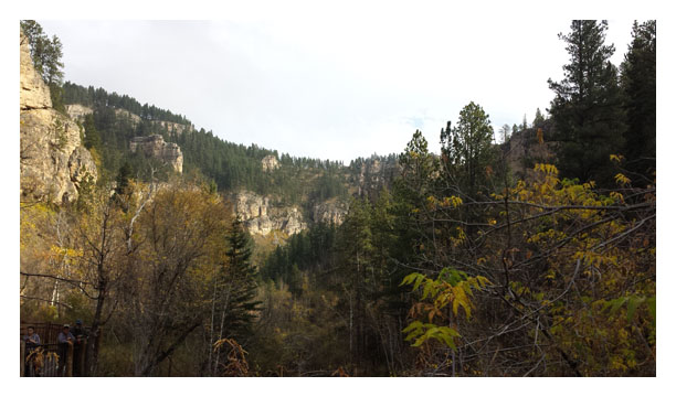
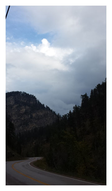
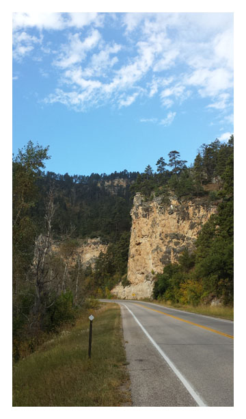
We kept watching the altitude on the GPS. I’m used to higher altitudes, and assumed we were not very high, but there were points as we drove through the canyon where we got to over 5000 feet. The roads were winding, some steep, with plenty of inclines and declines and switchbacks. We would often round a curve and see water crashing over a falls in the distance, but then never see it again. Spearfish falls was one of those – we caught a glimpse of it through the trees, but when we got to a sharp bend in the road that was also a wide spot in the road that included a restaurant, small hotel, and campgrounds, we could only see the very top of the falls where it started its descent. We could hear the falls, but there was no way to actually see it. There appeared to be a path below that we could have walked, had we been able to find how to get to it. Later my coworker told me that that path was closed for renovation. But I sure would have loved to see it from below.
A side road lead the way uphill to Roughlock Falls. All along the way up to this point, we had seen places where the creek had been dammed to provide spillways. Spearfish Canyon had been full of gold at one time, and the dams were used to power the gold mining operations. Roughlock Falls was named because a road went through there – the miners and others used it to go up and down the mountains. The road was so steep that they would chain the wheels of their wagons to descend, essentially “locking” the wheels so they would skid down the canyon rather than roll, overtaking their horses. Looking at what we saw in that canyon, I cannot imagine the cojones it would take to make that descent. Holy cow!
At the top of the little road, there was a picnic area, and event area (like for weddings). We could hear the falls, and there was a nice paved path that descended to the falls and then to the creek. The path was extremely steep, so we didn’t take it all the way down. We knew if we went all the way down, we’d have to walk all the way back up. Yeah, we’re wimps.  Everything was damp, whether from the falls or from the overnight moisture, it was hard to tell. The fall colors were past their prime, but the view was gorgeous anyway. The sun kept coming out, and the golden walls of the canyons just took my breath away.
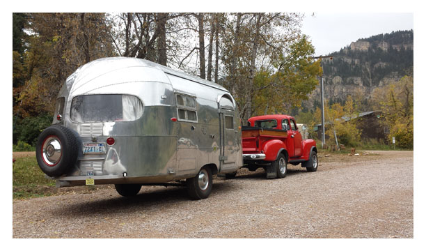 On our way back down the little road, we caught up with a beautiful little Airstream trailer and antique truck. My mom talked for a bit with the older woman passenger in the truck. She said that their trailer and truck were probably the most photographed in the country. I can see why. I cannot imagine taking such a setup into the mountains, especially with the steep switchbacks we had been traveling through.
One oddity about this day – we kept seeing Porsches on the roads. We did manage to talk to someone that was driving one. Apparently there was a Porsche convention going on in Rapid City, and events were being held in the Canyon as well. I didn’t know there were that many Porsches in the world!
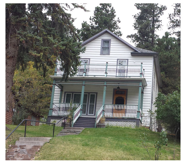
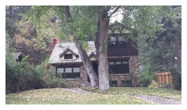
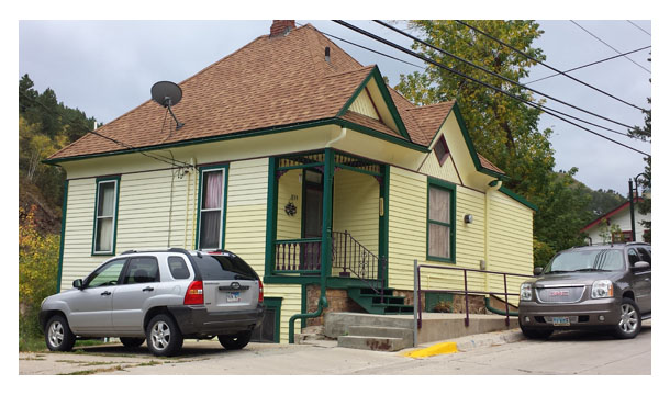
After the Canyon, we were on the east side of the Black Hills again. We traveled the highway up to Lead (pronounced “leed”) and then Deadwood. Lead was adorable, with cute little houses all tucked against the canyon walls. The town wasn’t even 1/4 of a mile wide – set right along the road with nowhere to build away from the main drag. And the homes in Lead and Deadwood were sweet Victorians in bright colors. You could tell there was money in the area, by the houses. Deadwood is one of the newest upcoming casino towns in South Dakota, which explains the money. Everyone is doing well there due to that industry.
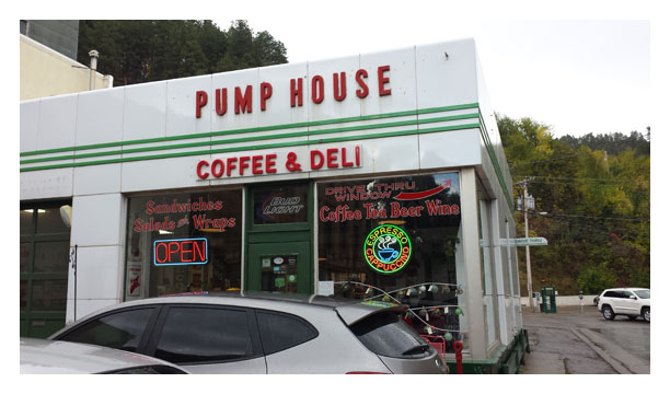 We had a late lunch at the cutest little cafe after wandering around (and getting lost) in Deadwood. It was in an old gas station. The bay area (where they would have worked on cars) now housed a glass blowing operation. The tiny “office” area was the deli/cafe. All of the sandwiches were named after car parts or repairs. Mine was the “Brake Pad,” meatloaf on ciabatta bread. Mom’s turkey-and-cranberry sandwich was called “The Strut.” Around the walls of the glass-blowing shop were all kinds of old metal signs that would have been in an old gas station. And a shelf high on the walls in the deli side held old cans of oil and lubricants. There were brand names I’d never heard of, and some that I remembered from my youth. All of the windows had been filled with glass shelves that contained some of the wonderful glass art the artist had made. When we were ready to leave, I took a few minutes to ask one of the deli clerks about the best way back to Rapid City. He grabbed a tourist map and drew us a route that would take us through some really pretty scenery and almost back to our hotel’s doorstep.
By then, the weather had turned dreadful – dark, damp, and raining lightly, but we still very much enjoyed the drive. We were near Rushmore and Crazy Horse at that point, and there were plenty of signs to tell us where to go. But Rushmore was set for the next day, so we passed that by. We did stop, however, to take a picture of the defunct “Presidents Park.” “All 43 presidents,” the sign boasted. “For Sale” was the bigger sign. The area would have made great campgrounds, I imagine. I should have called for pricing…
Enjoy the pictures below. We still have more journey to go!
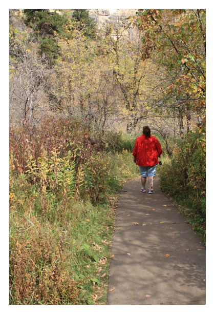
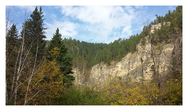
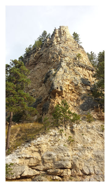
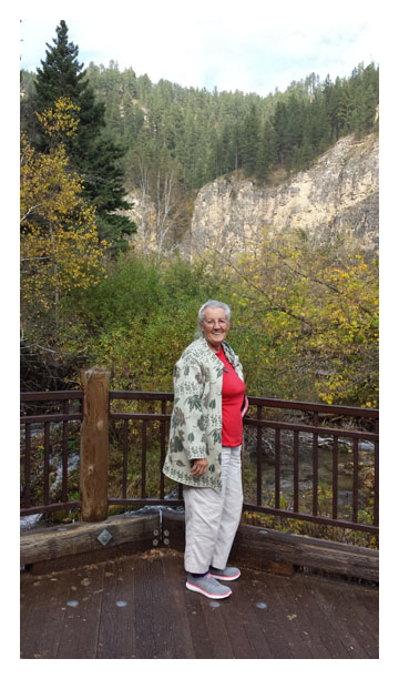
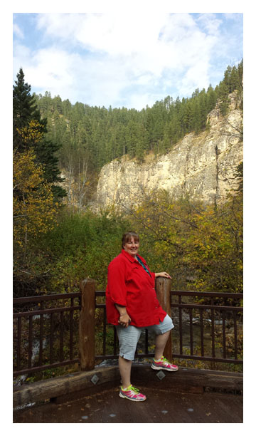
Pictures from the Canyon, in no particular order.
 Pictures of water – first Bridal Veil Falls.
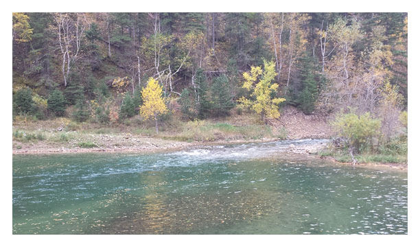
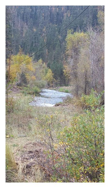
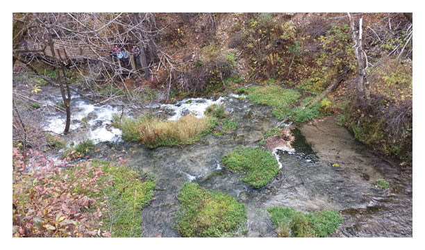
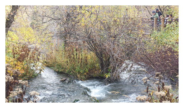
 Spearfish Creek. The first is one of the pools created by the damming of the creek. In the second one, there is a fisherman in waders on the bank.
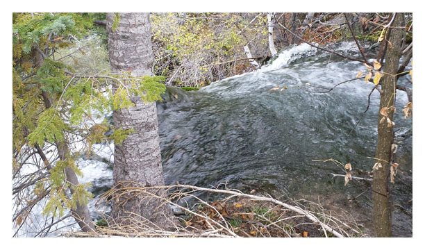
 Spearfish Falls – we could only see it from the top.
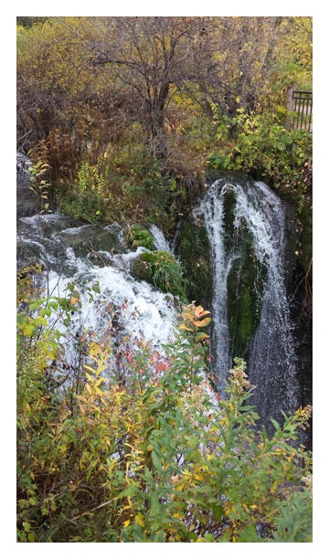
 Various pictures from Roughlock Falls.
Houses in Lead and Deadwood.
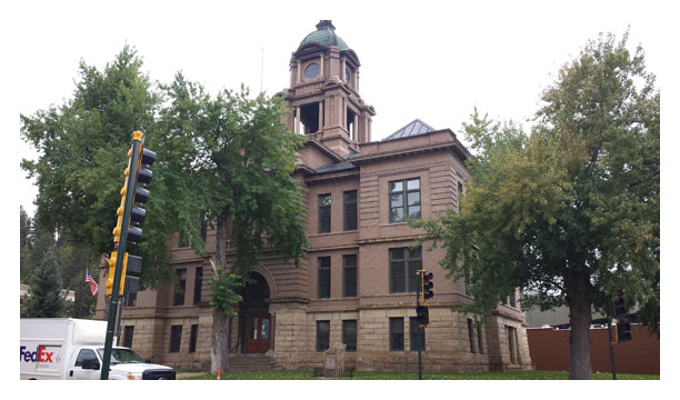
County Building in Deadwood.